
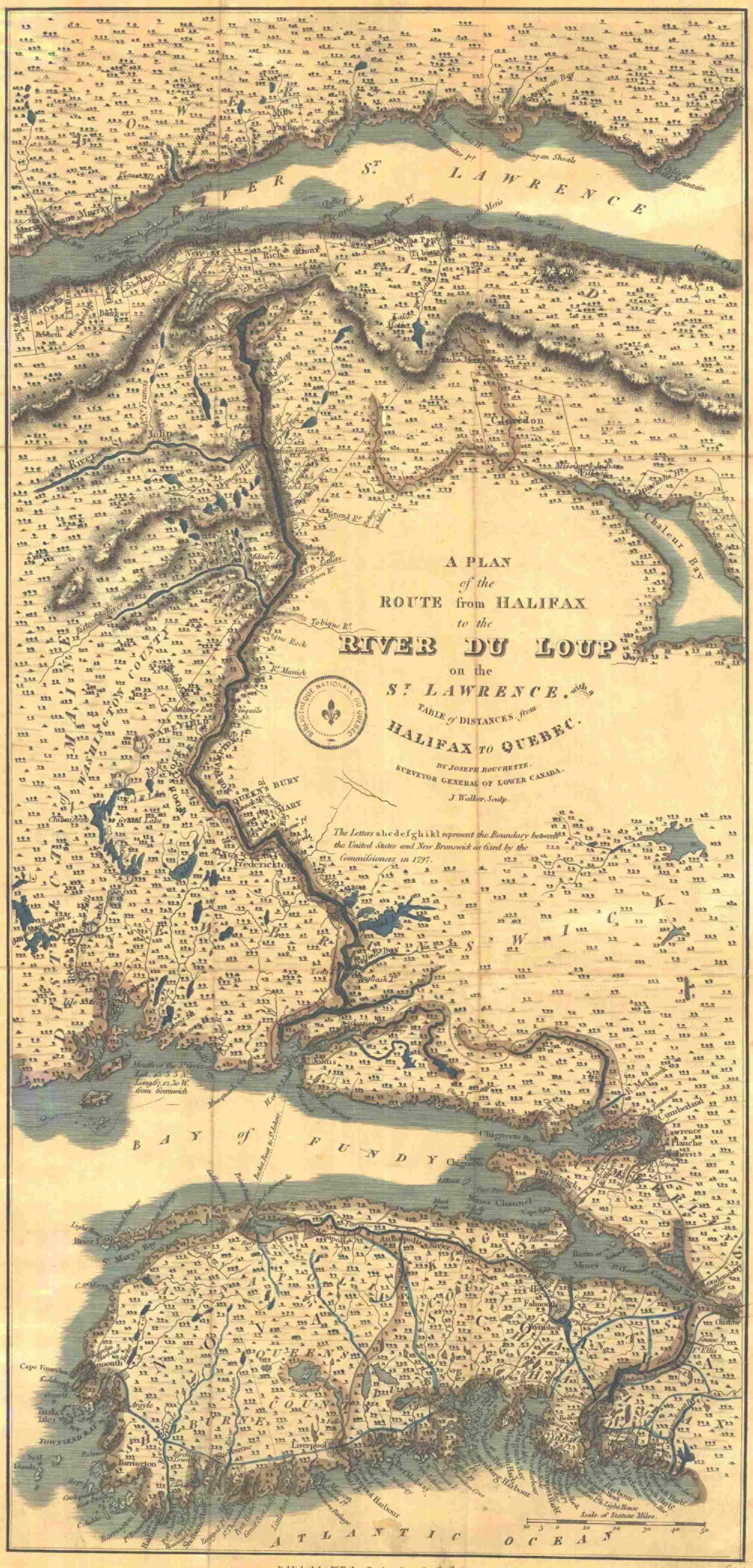
The road between Rivière-du-Loup and Halifax (1815).
© Bibliothèque et Archives nationales du Québec, digital coll.
In the early 19th century, a road connected the Maritimes to Quebec through the hinterlands along an old portage trail. The first section, labelled here as the “Temiscouata Portage,” starts near Rivière-du-Loup where the town of Notre-Dame-du-Portage can be found today. It leads to Lake Témiscouata, to the Madawaska River and on to the St. John River, which flows into the Bay of Fundy in New Brunswick. This road was especially used by military troops and mail-delivery coachmen. No one took it just for fun!
This map shows just how unpopulated much of the land southeast of the St. Lawrence Estuary was. Grand Portage Road followed the waterways that would later, particularly during the War of 1812, be the backdrop to the many negotiations to determine the definitive border between Canada and the United States. It was in Lower Canada’s best interest to control this access to its capital city of Québec.